The BEST of the Icefields Parkway Banff
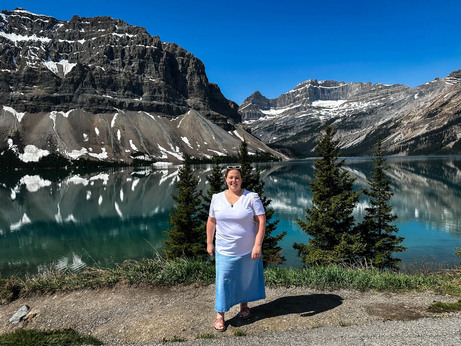
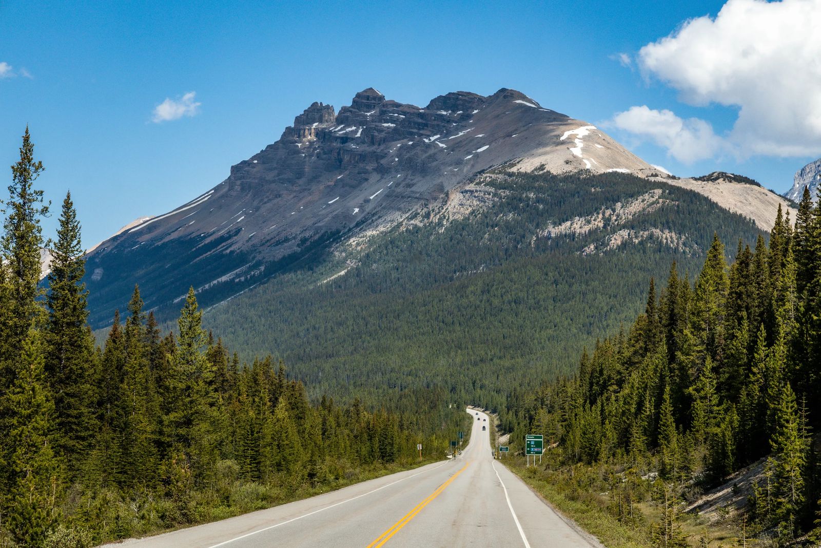
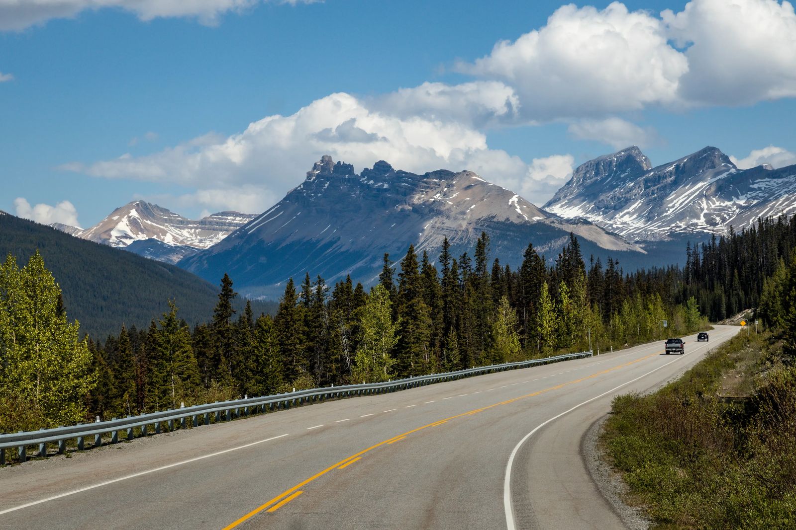
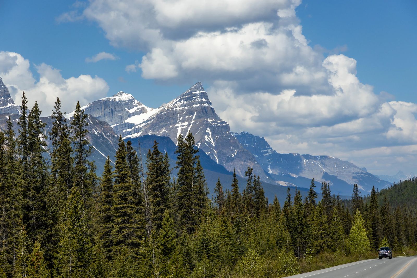
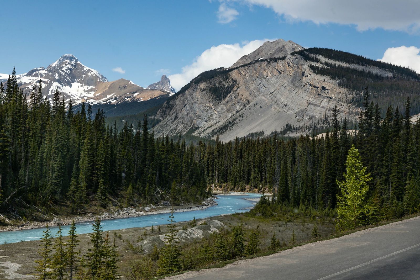
Stretching 143 miles (230 km) from the Trans-Canada Highway to Jasper in the North. As you drive along one of the most picturesque highways in the world, you feel as if you are traveling along the path of ice giants. The smooth slopes were slowly carved out by the glaciers over thousands and thousands of years. You can still see about 100 of these glaciers along the way from Banff to Jasper, but for today I'll just discuss some of the best of the Icefields Parkway stops from Banff to Jasper.
Please keep in mind that there aren't any gas stations along the route between Banff and Jasper so make sure you have a full tank when starting the journey. There are also very few rest stops along the way as well to use the restroom, so be careful how much coffee or water you drink. I'll mention a few that are available and the best spots on the parkway to stop for lunch as well.
Keep in mind that many of the stops along the parkway don't have signs telling you what is what, and where to stop - so doing a tour is a great idea, but it will also be hard to take the time to stop and admire each place. Take a look at the Open Top Tour offered by Pursuit of Banff and Jasper, you all have your own window and an open top to view from as well (like a Safari but better).
Animals & Foliage Along the Icefield Parkway
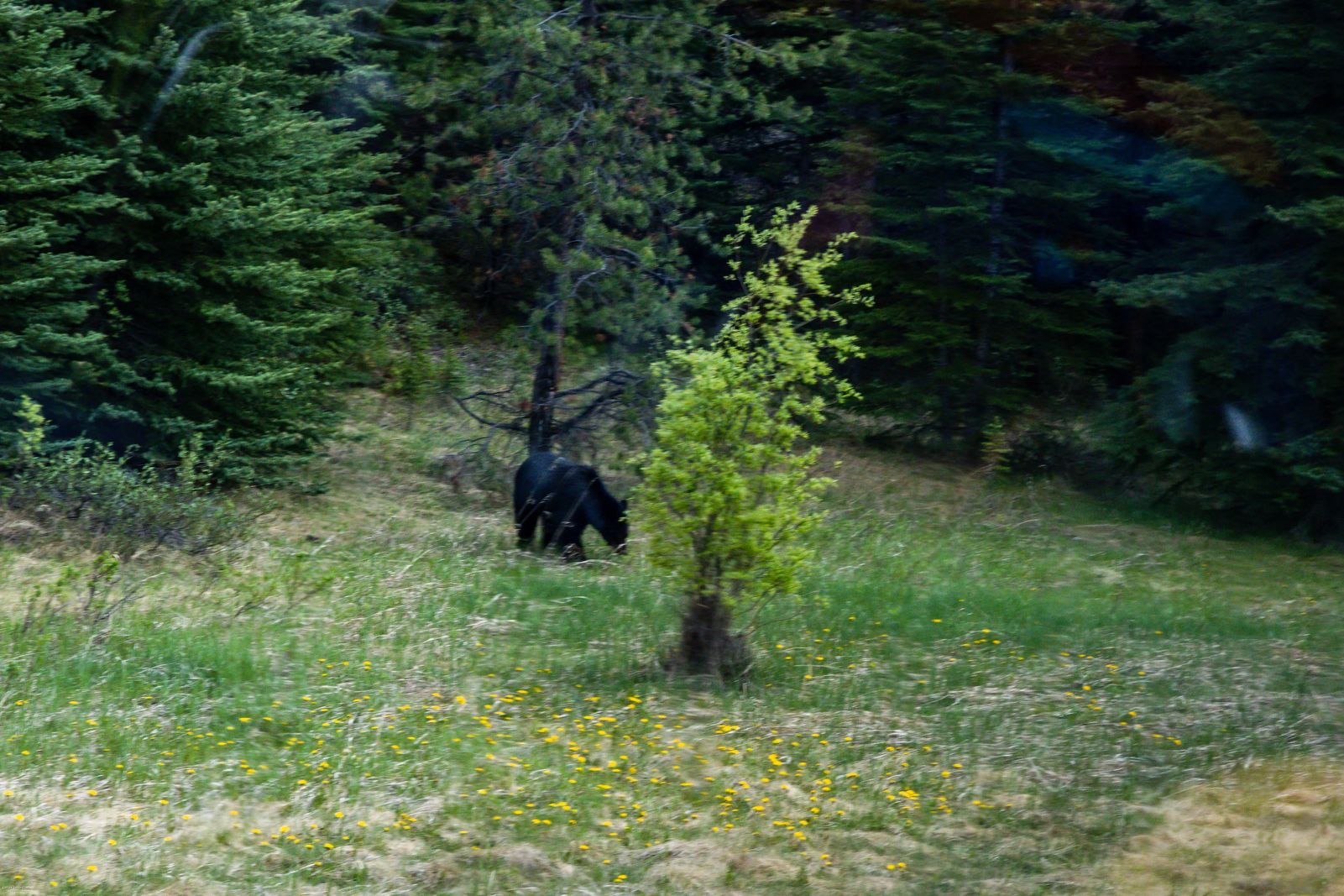
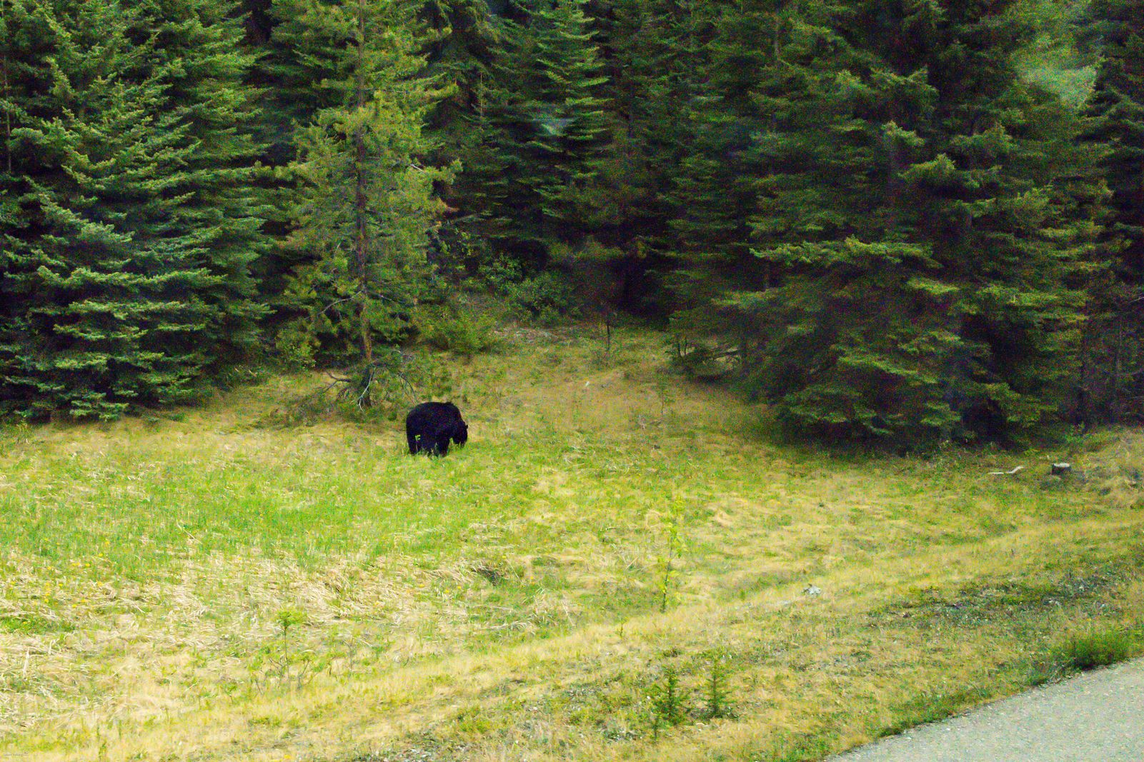
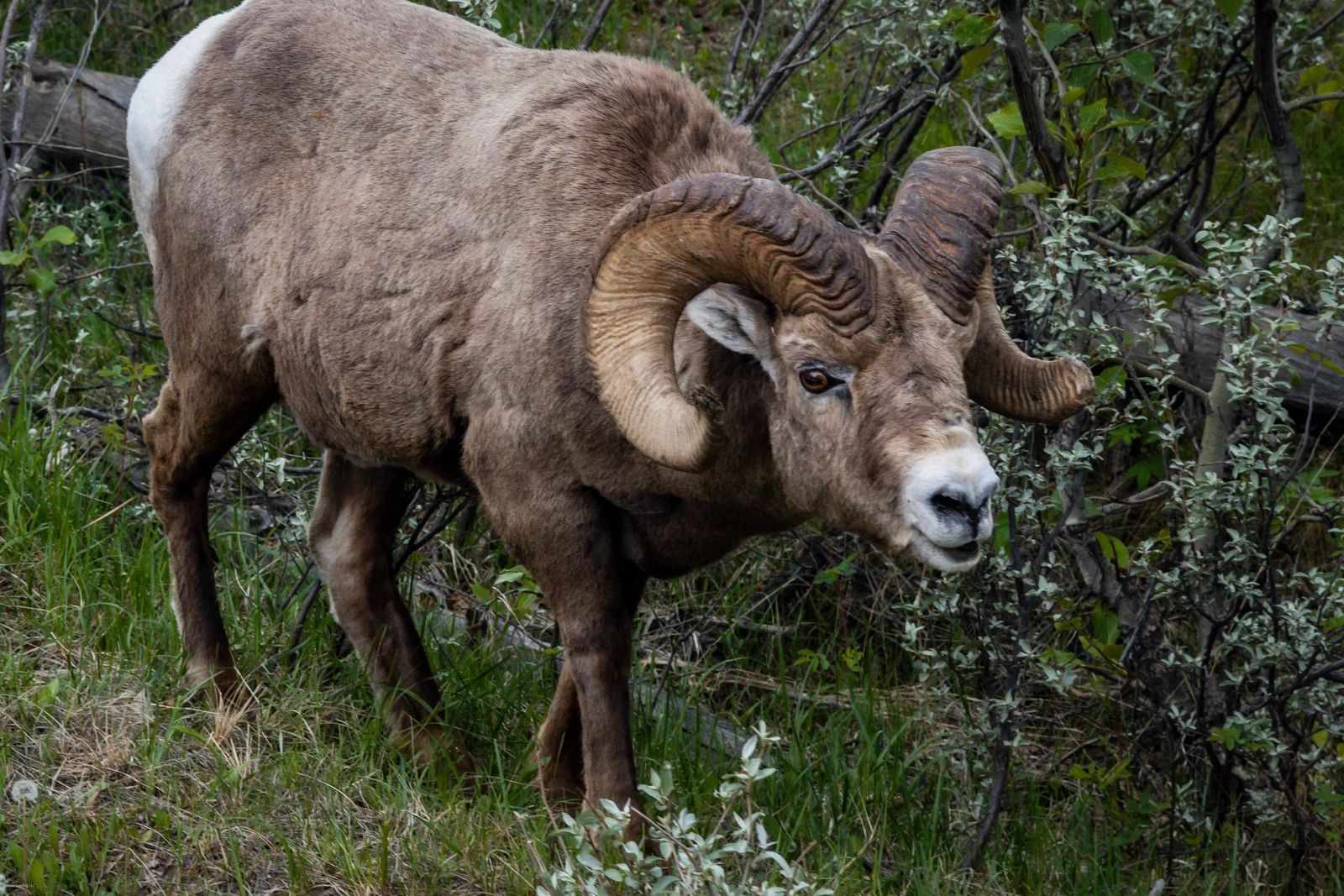
The closer you get to Jasper the more animals you will see, especially black bears as they love to eat the dandelions on the side of the roads in spring. Also keep an eye out for elk, moose, mule deer, bighorn sheep that like to hang out on the high cliffs, mountain goats (rare to spot), and coyotes. From the road, you will rarely see grizzly bears, wolves, caribou, and lynx.
You will want to bring your binoculars, GoPro with a clamp mount, and at least a 100-400mm lens if possible with a UV filter.
In Banff, you will see a lot of pine trees, spruce etc.. because of the elevation. As you drive along the parkway and get to Bow Lake and see the Crowfoot Glacier you will notice the subalpine zone shift with Engelmann spruce, lodgepole pines, and whitebark pines. During July and August, the wildflowers here are a sight to behold.
You will see layers of white mountain avens, heathers (white, yellow, red), western anemone, globeflower bloom, blue alpine forget-me-not, and cream-colored rock jasmine.
Birds like Clark's nutcrackers collect pine cones, hermit thrushes, crossbills, white-crowned and fox sparrows, rosy finches, and white-tailed ptarmigan. The white-tailed ptarmigan is the only bird that stays here throughout the harsh winter months.
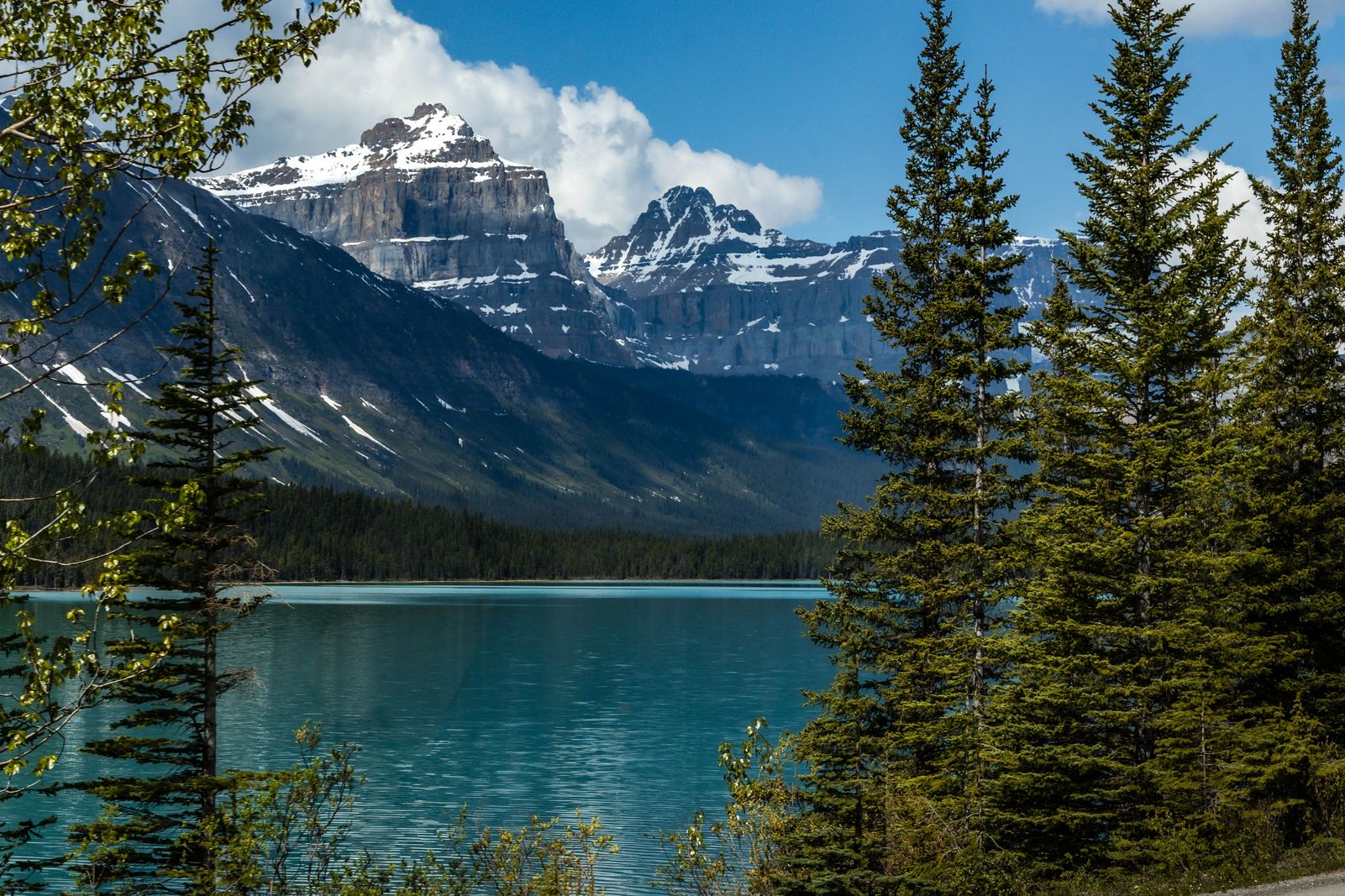
Hebert Lake
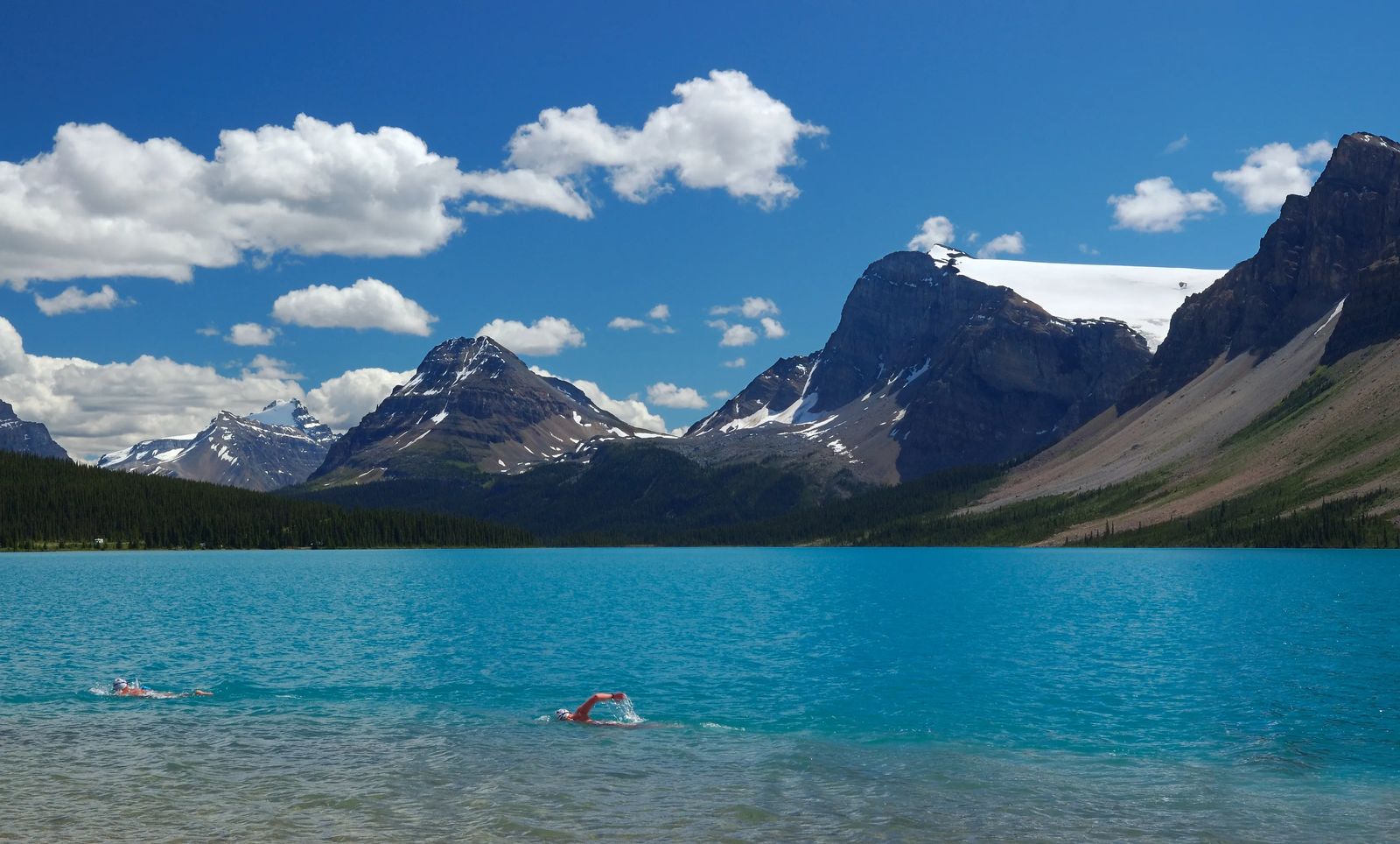
This is a beautiful lake right off the side of the road with a little picnic area with the Bow Range right in the back. Mount Temple dominates the range at 11,626 ft, with Mount St Piran, Mount Niblock, and Mount Whyte flanking it. Herbert Lake is a sink lake and is only about 44 ft deep and because of the shallow depth is a bit warmer for visitors to swim in than the nearby Lake Louise. While still cold it is a great spot to swim if you can stand the cold waters.


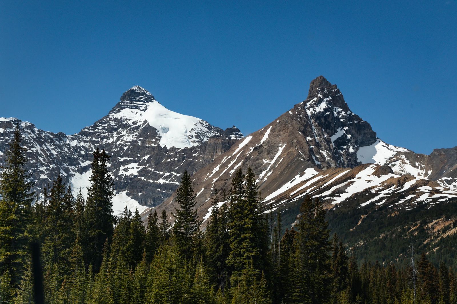
Hector Lake Viewpoint
Named after the first white explorer who visited this valley, Dr. James Hector. This is the largest and deepest natural lake in Banff National Park. The mountain range around this lake is the Waputik Range (means 'White Goat' in Stoney language).
Pulpit peak is the highest peak in along the mountain range near the lake. The waters of Hector lake get them from the nearby Turquiose Lake just above this one that is fed by a glacier flowing down the valley.
Mosquito Creek Campground and Hostel
Named after the first white explorer who visited this valley, Dr. James Hector. This is the largest and deepest natural lake in Banff National Park. The mountain range around this lake is the Waputik Range (which means 'White Goat' in the Stoney language).
Pulpit Peak is the highest peak along the mountain range near the lake. The waters of Hector Lake get them from the nearby Turquoise Lake just above this one that is fed by a glacier flowing down the valley.
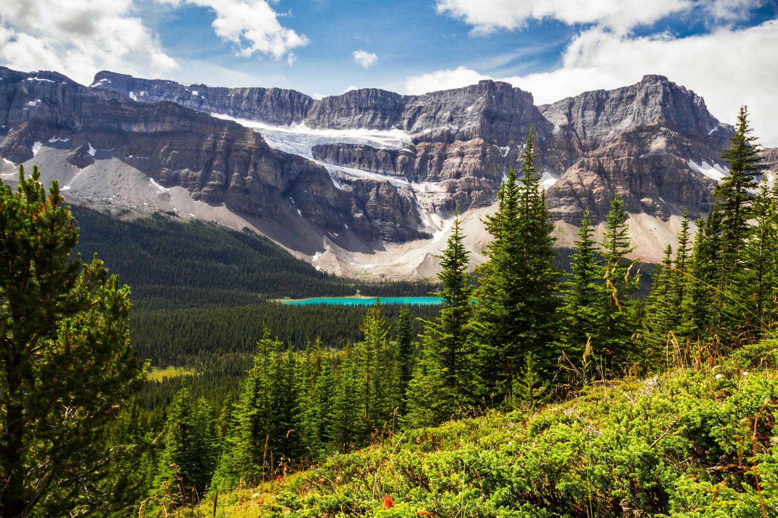
Helen Lake Trail
This is right across from the Crowfoot Glacier and is a 3.7-mile (6 km) trail that leads you past alpine meadows onto Helen Lake. It is a great day hike for those wanting to experience the Canadian Rockies without hiking something too long and difficult.
Bow Glacier Falls trail
This 2.9-mile (4.7 km) trail leads you out to Bow Lake and then along the North shore of the 1.5-mile lake up to view the Bow Glacier Falls.
Just below this trail, you can also find the Num-Ti-Jah lodge originally built in the 1920s by the explorer Jimmy Sampson, then rebuilt in the 1950s which is how it still appears today. You can stay at the lodge, and there is a small gift shop here in the summertime (www.num-ti-jah.com).
Bow-Summit
At 6,790 ft (2,069 m) this is the highest point on the Icefields Parkway. The winter snow here, in the summer feeds the Saskatchewan River systems on both sides of the mountains. This in turn feeds the famous Hudson Bay miles away and even some parts of the Western United States.
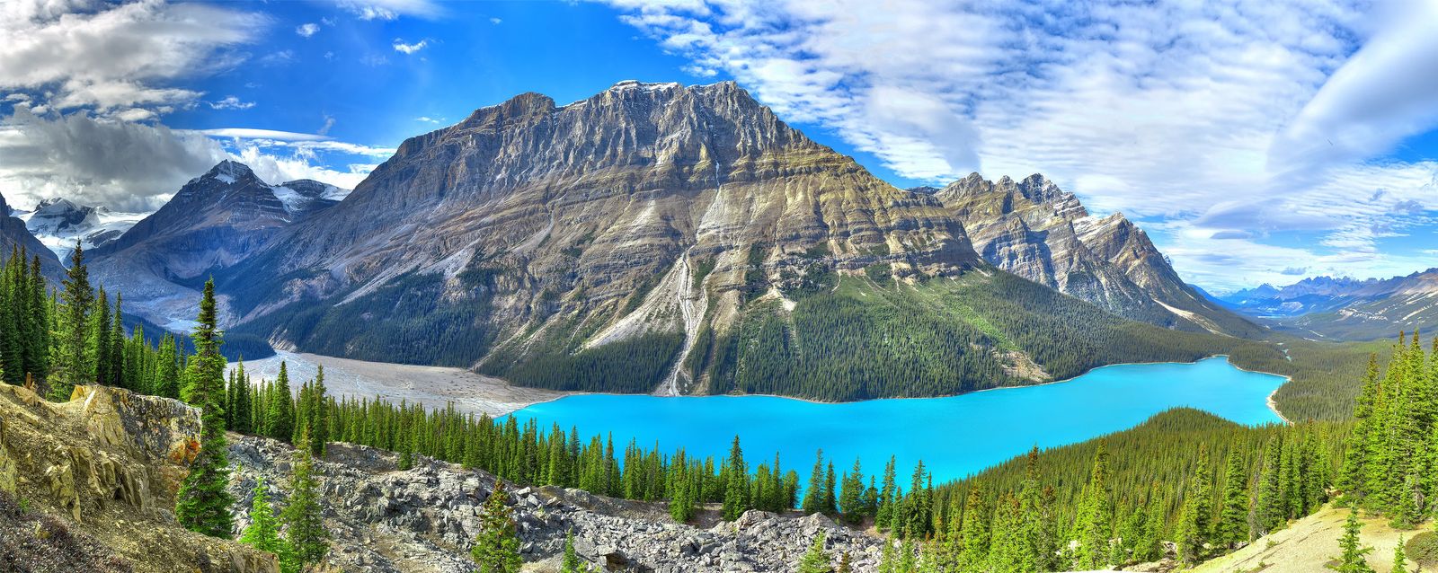
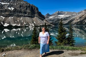
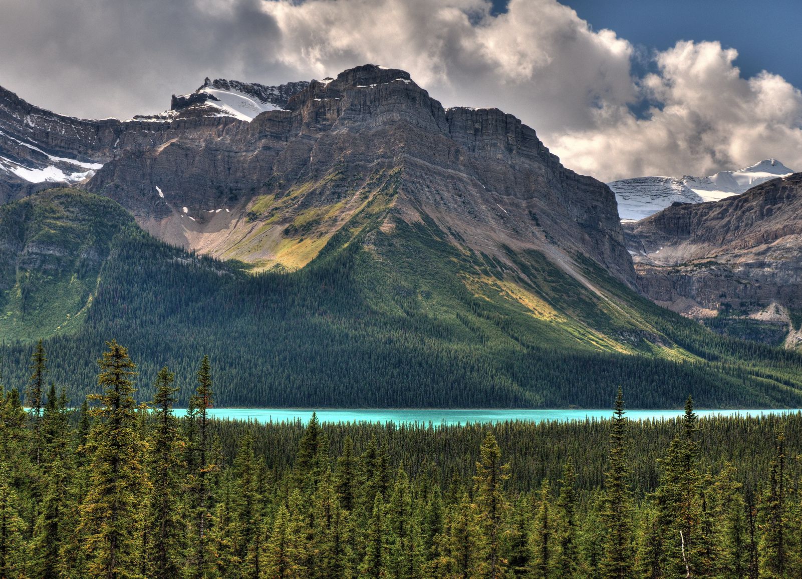
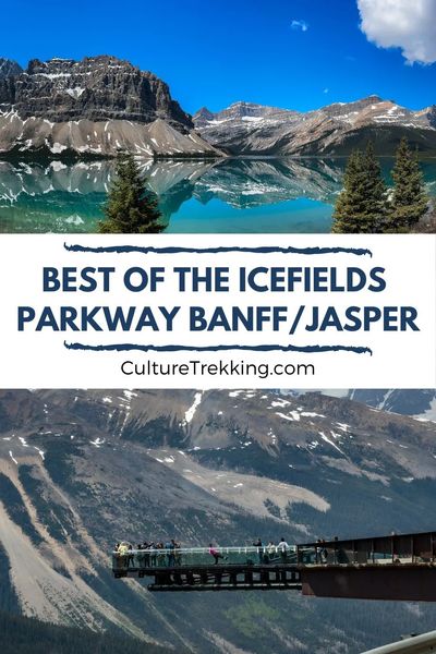
Peyto Lake
This is one of the more famous spots for Banff and Jasper National Park, Peyto Lake. The beautiful blue waters against the backdrop of mountains and surrounded by dark lush green forest make the colors pop. It is fed by the Peyto Glacier which is on the southwest side of the lake. It is the glacial 'flour' of grinding rocks under the massive tons of ice that flow with the waters into the lake that give it a beautiful blue color.
There are lots of options for both viewing and hiking around this area, and seems to be a bit less crowded than the popular Lake Louise and Moraine Lake.
The viewpoint is off the Parkway on Bow River summit, once you get to the parking area it is a 0.3 mile (0.5 km) walk along the paved trail to the viewpoint. Below you can see the beautiful lake 790 ft (240 m) stretching out in complement to the Mistaya valley.
You also have the Peyto Lake East trail (0.9 mi/1.4 km) that takes you along teh shoreline (it can be a bit of a sludgy walk). Or the Peyto Glacier Viewpoint on the east side.
Other Campground Options
Near these sites, you have the Silverthorn overflow Campground which is an overflow campground for the North of Banff. There is also the Waterfowl Lakes Campground (the favorite of many camping platforms) as Moose come here often and there are 116 sites, but they are all unserviced so make sure to pack out what you pack in. These are only open from July to September though because of the elevation and distance from any town.
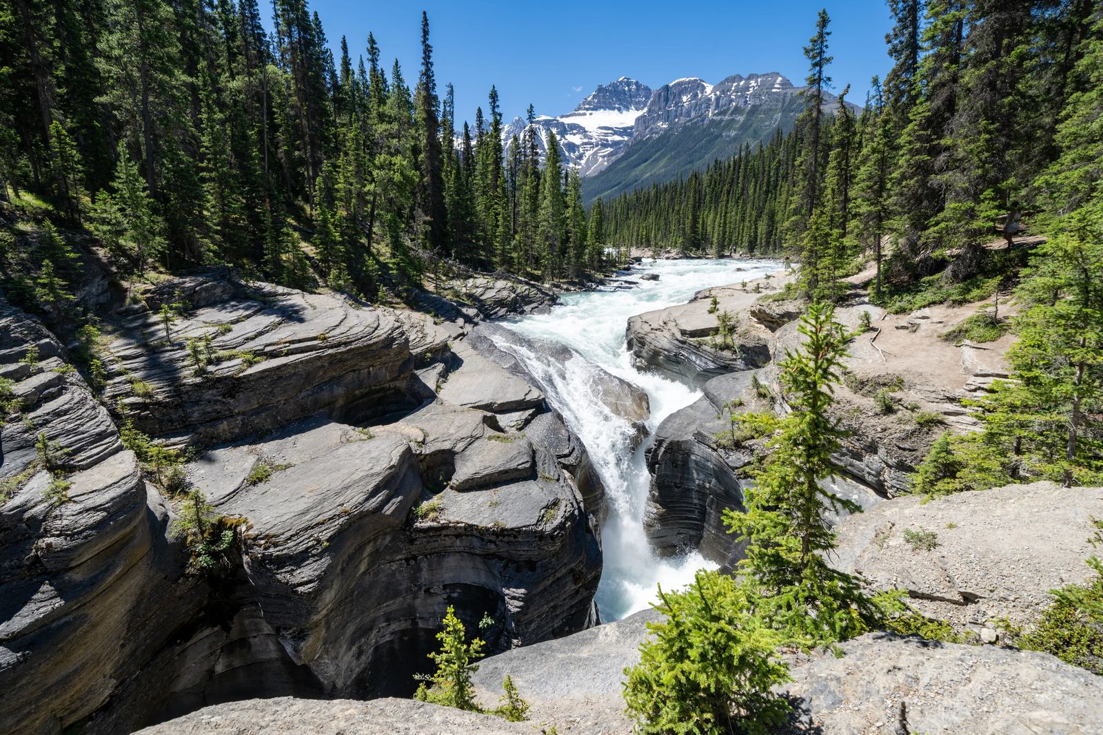
Mistaya Canyon
There is an unmarked roadside parking area for the Mistaya Canyon Trail that drops down 0.3 miles (500 m) to one of the most impressive limestone slot canyons in Canada. It is a narrow gorge that is cut deeply into the bedrock which the Mistaya River weaves and winds its way through. The current is really powerful so don't try to go swimming as no one will come to rescue you. Mistaya means Grizzly Bear in the Cree language.
If you keep following the trail past the bridge there is an old fire lookout about 3.2 miles (5.2 km) down the trail as well.
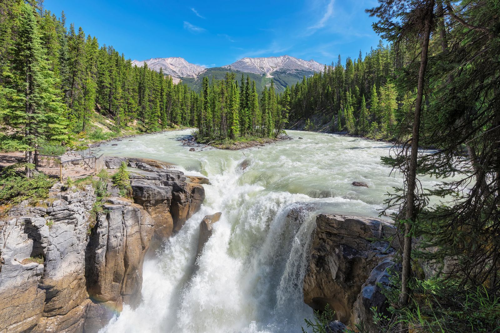
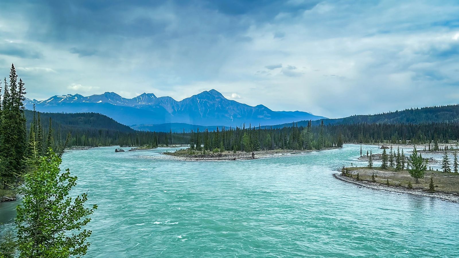
Saskatchewan River Crossing and Crossing Resort
There is a rest stop here right before you reach the Colombia Icefields with the famous Athabasca Glacier. Inside you can find a small fast-food-type cafe, to-go food items, LOADS of road trip snacks, and beautiful sweeping meadows surrounded by tall peaks. You can also see the informational signs right outside that provide insight into how the First Nations lived here, who the tribes were, how they interacted with settlers, and the resources they used, who stayed during winters and more.
Rampart Creek Campground
This is the last campground to fill up during the summer as it is the furthest campground North in Banff. All sites are unserviced, but it has 50 available and is open from June to August.
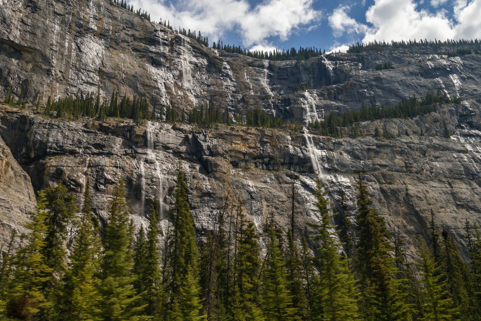
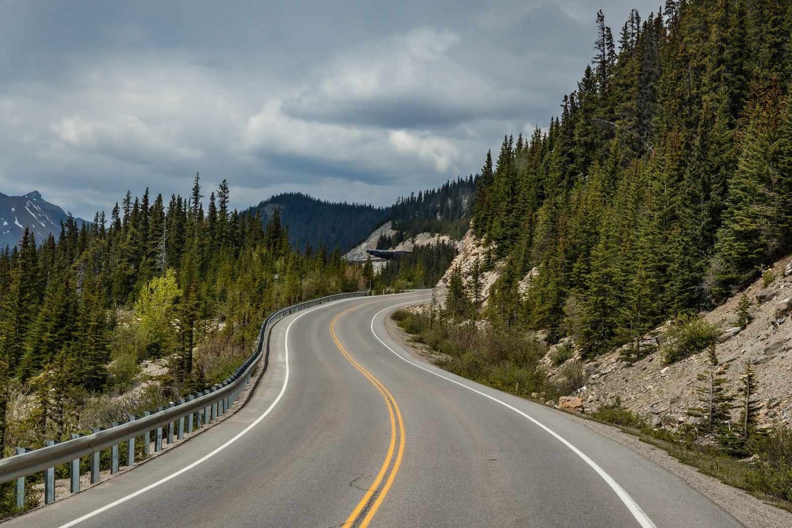
Weeping Wall
Just past the Cirrus Mountain viewpoint, you will find the Weeping Wall. If you aren't looking for it you can drive right past it, but you can typically see a few people parking on the side of the road to go take photos. There is a steady flow of water over the sheer limestone cliffs in the spring and summer that stains it dark, making it look like the mountain is crying or weeping.
Saskatchewan Glacier Trail
Following the Saskatchewan River towards Lake Louise, you can stop at the Saskatchewan Glacier Trail. You can see a small area to pull off near the old Banff-Jasper Highway below (now blocked to traffic) this is the start of two different easy trails. One trail takes you to a cataract, the other takes you to the morainal plain at the foot of the Glacier.
You will pass waterfalls along the gorge to the cataract that was once a popular stop for tourists along the old road. The other trial cuts along a rough footpath following the river until it meets the former toe of the glacier (now you have to scramble up quite a ways to reach it), then takes you along a ridge into the huge basin the glacier created.
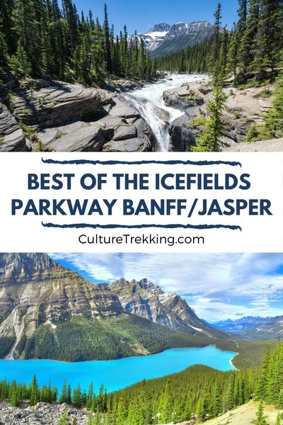
Panther Falls Trail
This is the highest waterfall in Banff National Park and is a short 0.6 mile (1 km) to the falls. It was named after some rock formations near the cliff that looked like a Panther (see if you can pick it out).
Just down the road from Panther Falls you also have Bridal Veil Falls which is the second-highest waterfall in Banff and is viewable across the valley from the parking area.
Nigel Pass Viewpoint
The trail down in the valley is the south part of Jasper National Park is a great place for mid-summer hiking. This is also where you will want to carry bear spray and a bell of some sort as grizzly bears are often seen in this area digging around for Hedysarum roots.
Remember that if there is a harmful interaction with humans, or they get food from humans the bears have to be put down to protect the rest of the people visiting the park. Please be safe, carry the required bear spray, bell, and horn if needed. Let people know where you are hiking and if you see a bear, immediately back away as you calmly talk to it.
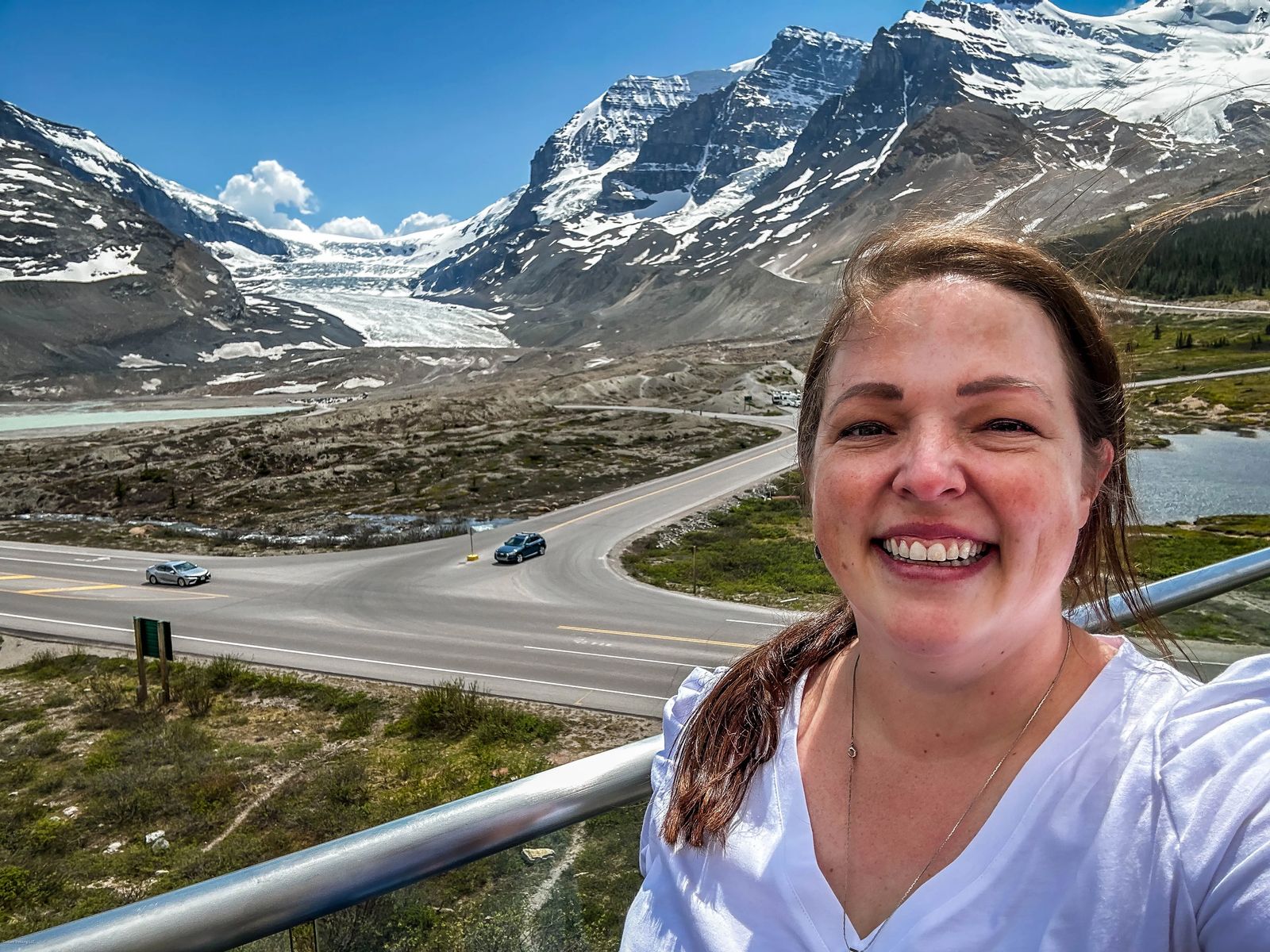
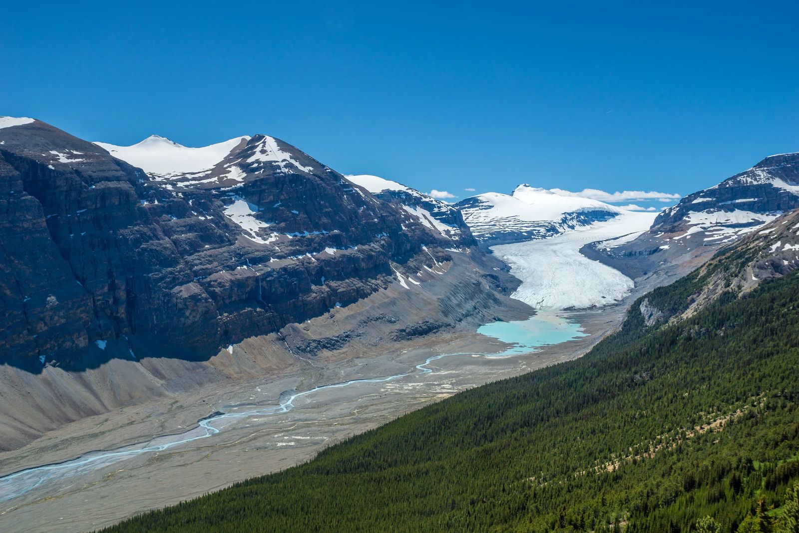
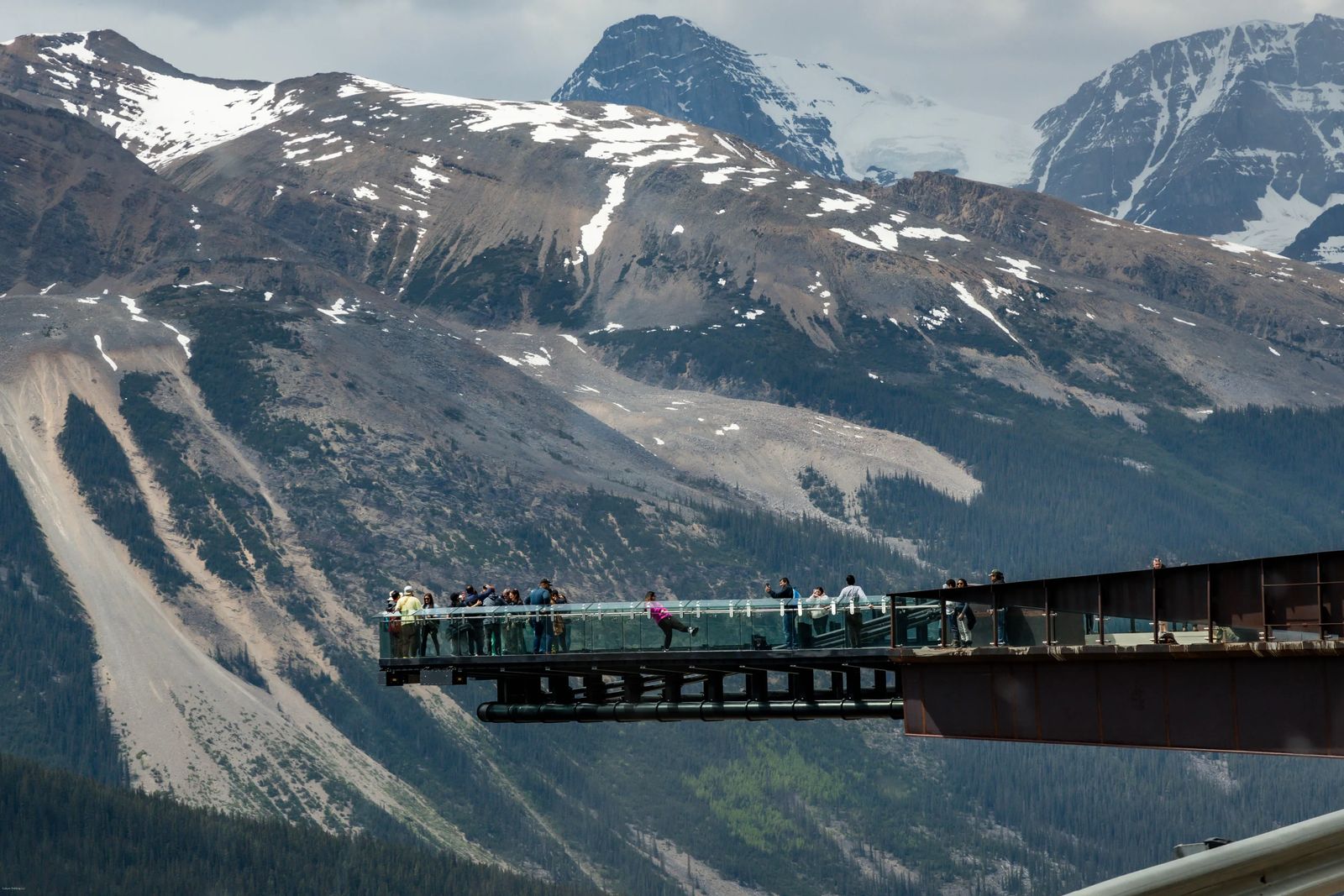
Columbia Icefields
As you enter Jasper you will start seeing all the famous glaciers in high concentration. First, you see Saskatchewan Glacier on the Banff side. Then you approach the tail end of the Athabasca Glacier, cross the pass, and then see the massive and incredibly impressive Athabasca Glacier.
It is sad to see how far the glacier has receded due to global warming. I remember visiting the glacier as a child in the 90's and the glacier reached all the way to the parking lot near the road. Now there are two parking lots and a short hike to reach it.
Any visits to the Athabasca Glacier MUST be guided as the landscape of the glacier changes daily and can be very dangerous to traverse on your own.
Here you can also find the Icefield Skywalk maintained and owned by Pursuit of Banff and Jasper. They also provide bus passes and guided tours/hikes on the glacier itself with the snow cats. You can find a lunchroom and a fine dining restaurant here, along with a souvenir shop, lots of picnic tables and chairs to admire the glacier, as well as nice restrooms and hot beverages to help you warm up.
The icefields can see 23 feet of snowfall per year, and the ice here can reach depths of 1,200 ft (635 m). It can take about 150 years for the ice to reach the edge of the glacier, with some estimates showing ice as old as 400 years.
Sunwapta pass
The waters that drain from the Athabasca Glacier here drain to the waters that feed the Arctic Ocean via the McKenzie River. It also feeds the rivers that flow to the south feeding the prairies close to the Nelson and Saskatchewan rivers that eventually lead to Hudson Bay.
The pass also is the boundary between Banff and Jasper National Park. You can also find the Wilcox Creek Campground right near here which is the highest campground in either park with 46 sites.
Wilcox Pass Trail
You can access this trail from the Wilcox Creek Campground which is a 2.5-mile (4 km) trail that takes you up the pass between Mount Wilcox and Nigel Peak and gives you a fantastic view of Mount Athabasca and the Glacier. People will commonly see Bighorn Rams along this trail as well.
The Ancient Forest
As you pass Mount Wilcox, you enter the ancient forest of Engelmann and spruce trees. It has some of the oldest living trees in the parks with the oldest Engelmann Spruce Tree dating to around 1265 A.D.
HI-Beauty Creek Wilderness Hostel
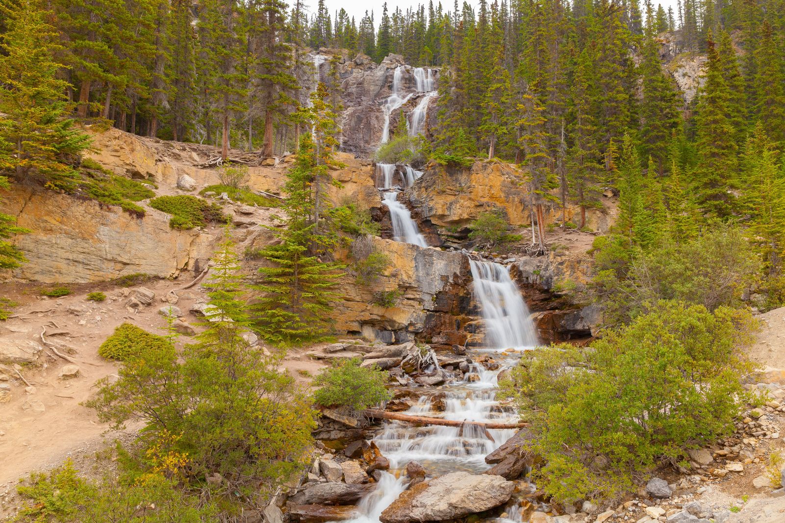
Travel past the Tangle Falls, Stutfield Glacier viewpoint, Beauty Creek Trail and you will reach the Beauty Creek Wilderness Hostel. It is open from May to September and has 22 spots for visitors to rest. There is a kitchen, thermal shower, fire pit, and pancake breakfasts for visitors (www.hihostels.ca).
If you explore the trail starting from the hostel (9.3 mile trail) you can often see caribou closer to the highway. They look like the caribou (reindeer) you find in Finland, but they are different in that they don't travel in herds, are more solitary and quite shy. Their biggest threat.....cars....so keep the speed limit and stay aware as there are less than 300 of them in the parks now.
Sunwapta Falls Junction
There is a parking area for this popular view point where the river from the Athabasca valley makes an abrupt change in direction (likely from a glacier stopping its path). The Sunwapta Falls gush over the cathedral limestone creating these smooth walls that are rather beautiful against the swirling raging river that cuts through it.
If you want to get a good view of the river and canyon follow the Fortress Lake Trail (15 mile/24 km) that spits you out to one of the largest lakes in Canada. You can also take the shorter Lower Sunwapta Falls trail that is 0.8 miles down. If you continue along the trail it will lead you out to the Athabasca Valley.
Sunwapta in Stoney language means 'turbulent river'.
There is also the small 35-site campground just down the road from Buck Lake and this trail called Honeymoon Lake Campground. Keep traveling along the highway towards Jasper and you will run into several other campgrounds like Mount Kerkeslin Campground, and HI-Athabasca Falls Wilderness Hostel.
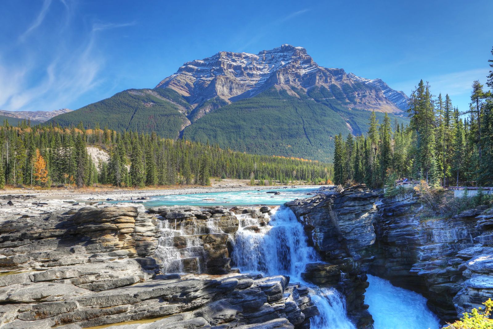
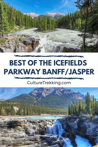
Athabasca Falls
These falls are right at the junction of Highway 93A and are a sight to behold. The water drops Into the quartize gorge and over time has smoothed out the walls of the canyon. Across the valley, you can see the 9,790 ft (2984 m) Mount Kerkeslin.
Valley of the Five Lakes Trail
If you hike this 1.4 mile (2.3 km) trail you will be greeted not just by five small lakes but likely lots of wildlife. Muskrat, moose, bear, common loon, barrow's golden-eye, MacGillivary's, yellow-rumped and yellow warblers, northern water-thrushers, and yellow throats.
Approaching Jasper
As you get closer to Jasper you will pass the Icefields Parkway Gate for those going Southbound. Just outside these gates is Becker's Chalets (rooms, restaurants, gift shop), Wapid Campground (322 campsites, elk common here), Whistler's Campground, and the Miette River Bridge. Through the centuries fur traders, gold rush and railway workers walked along this peaceful river as well.
Jasper landscape certainly changes in the fall here with the white spruce, and lodgepole pines contrasting against the changing colors of aspen poplar and white birch it is a sight to behold. Jasper is also considered a dark sky park so it would be worthwhile to visit in the fall as well for the dark sky park festival.
My Takeaway of Visiting The Icefields Parkway in Banff and Jasper
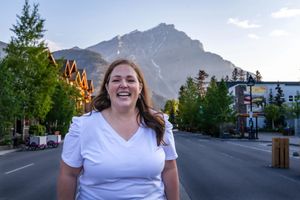
I like to call myself the master of road trips having driven from Utah to Montana, Texas, Idaho, Oregon, California, and Colorado and from Alabama to Florida, Georgia, Louisiana and all over Scotland, the Balkans, Baltics, and more. The Icefields Parkway in Banff and Jasper is by far the most scenic highway I've ever been on in my life. I could NOT stop taking photos and kept filling my SD card with videos and photos, asking our Brewster Bus Guide questions for hours and hours til he finally just gave me his book to read later, lol. While there is a LOT to see between the two parks, the parkway should at least take two days if not more to properly explore, hike and enjoy.
I hope this guide was helpful to you, please let me know if you decide to go and what you are most excited to see in the comments below.
Guided Tours of Banff and Jasper
Where to stay in Jasper
Like it? Pin it for later! Sharing is caring ;)
.jpg?fit=outside&w=1600&h=2399)
.jpg?fit=outside&w=1600&h=2399)
.jpg?fit=outside&w=1600&h=2399)
.jpg?fit=outside&w=1600&h=2399)
Latest Articles On Culture Trekking


Welcome to Culture Trekking!
My name is Janiel, a leader in the travel industry with over 20+ years of experience with international travel. I specialize in solo female travel, cultural connections, sustainable adventures, food and history to help make your travel experiences fun, meaningful, and delicious. My experience in travel, and my personal story have allowed me to get published in Fodor's Travel, Atlas Obscura, Metro.co.uk, Trip Advisor, and multiple Podcast interviews. You can find me on pretty much every social media channel YouTube, Instagram, Twitter, Facebook, Pinterest, TikTok. To read more about me and my story click here. If you are a brand and would like to work with me, click here.